Up and over Forester Pass, at 13,200' the highest elevation on the PCT
- Date: Thursday April 30, 2015
- Miles hiked: 9.83 PCT miles, plus 7.XX exit over Kearsarge Pass to the Onion Valley Trailhead via the Bullfrog Lake trail
- Miles covered: 778.64 to 788.47 PCT
- Weather Report: Low 14, High 70. Very cold overnight, reaching a low of 14 around 1pm. A south wind brought the temperature up to 26 by sunrise at 6am. Up and over the pass, temps near 50 and clear and no wind. Warmer through the day, reaching 70 in Vidette Meadow. 40's over Kearsarge Pass into Onion Valley.
- Wildlife seen: Woodpeckers.
- Mood of the day: Adventurous
In brief, here are the conditions I found going up and over on Forester Pass from the south:
- The first quarter mile up the pass was generally snow covered, then the trail was fairly easily followed up to the top
- There was no snow at the chute just below the pass
- The trail at the pass was covered with maybe six or eight feet of snow; I couldn't really see the ground
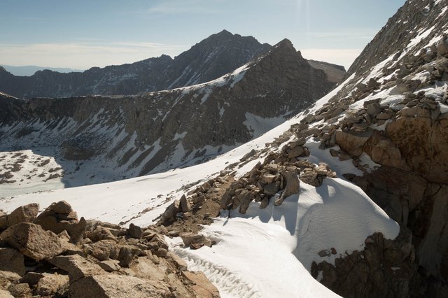
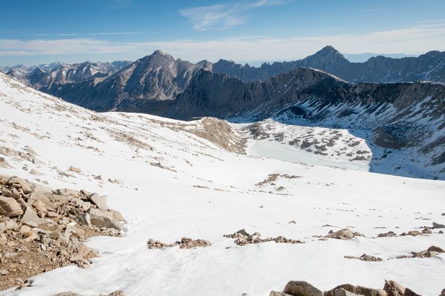
- On the north side of Forester Pass, an extensive snowfield covered the trail and the slope to about mile 780.2. Glissading down got us down the steeper slopes quickly
- The trail north of 780.2 to 781 was easy to identify, but often had snow in the track
- From 781 to 781.8 the trail followed a shallow snow covered valley, it was slushy and postholing took a long while
- From 782.7 to well past 783 the trail ran along a northwest facing slope with many snow drifts to detour around. We skipped this section.
I'd consider decent navigation and basic snow skills to be necessary; the crossing did require some technical expertise. My GPS with the PCT track loaded was extremely useful, and my ice ax was necessary for cutting a few steps, but more importantly for quickly digging myself out of deep postholes.
I slept poorly. When I went to sleep around 9:30, the temperature outside was already 25, the air still, and it dropped to 14 just after midnight. The mushy ground underneath the tent--calling it semi-unfrozen tundra is pretty accurate--did harden up overnight, and by morning I knew the location of each of the three rocks I contorted myself around, trying to find a comfortable position. It was as comfortable as sleeping overnight on some cheap airport terminal seating.
I did sleep warmly, though, and did the mylar space blanket trick over my feet (got to find a better solution. Make a Tyvek burrito of my sleeping bag? Insert the foot of the sleeping bag in my rain jacket?). A south wind had warmed the temperature outside to 26 by first light around 5:30, and I packed up as best I could. I wanted to be out of there, over the pass, before it got too warm and too slushy up on the snow.
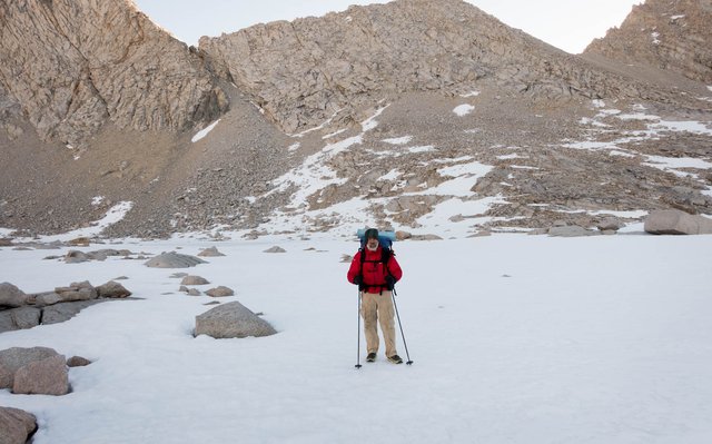
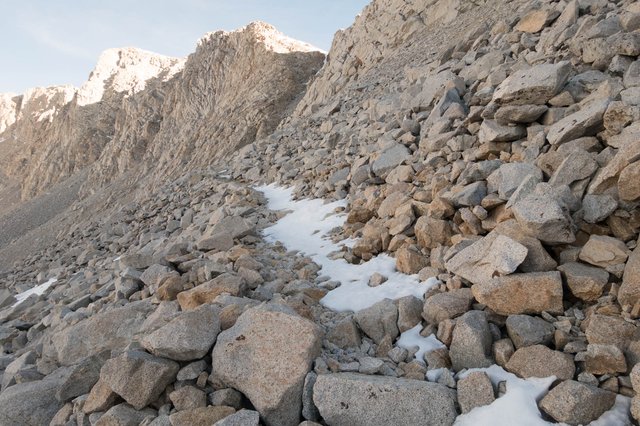
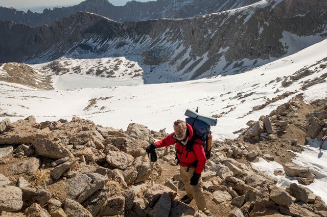
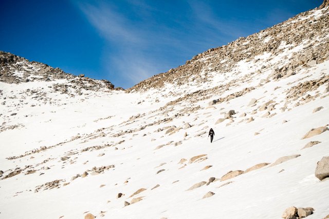
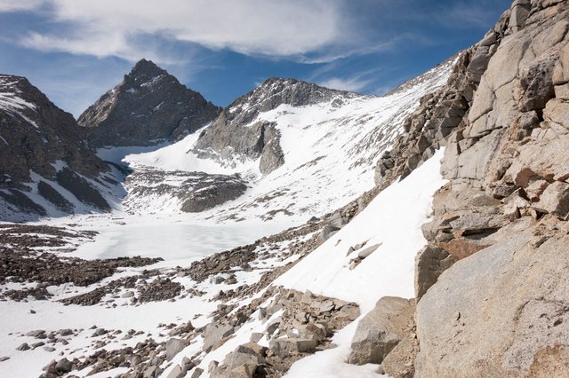
Joko and I left our semi-thawed tundra campsite at 7:15, and headed up the very forbidding looking Wall that loomed above us, 700 feet high. We crossed the hard snow over to the foot of the climb, and headed on up, skirting some snow-covered patches for the first quarter mile by scrambling up the boulders: hard work, with so many loose rocks, and the snow melt from yesterday had glazed the rocks overnight with ice.
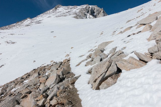
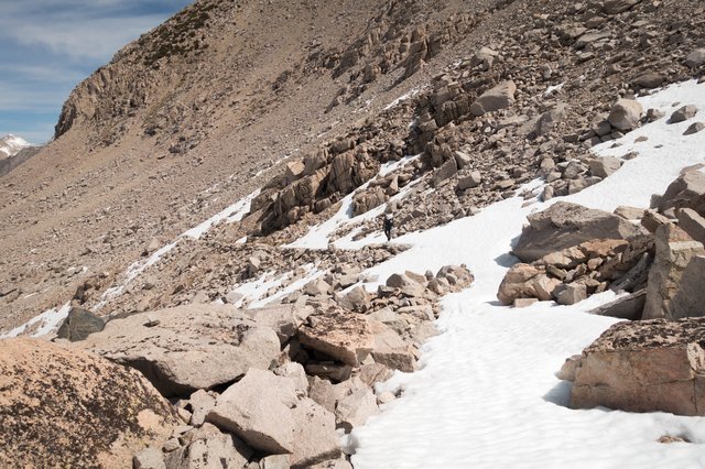
After that first tricky bit, things got easier, and we could follow the trail, though at several spots it wasn't walking but more "balance for the next twenty feet along the outside edge of the trail to avoid the snow bank covering most of the trail". It was also quite high, we were closing in on and then exceeding 13000' elevation; lots of rest stops were needed. At least it was shady, as the sun hadn't come over the sharp serrated ridge line above us.
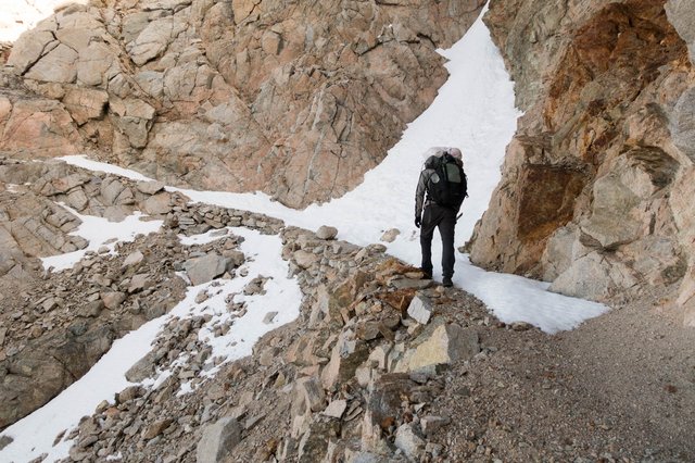
Just before the pass, we crossed the notorious Forester Pass ice chute, a section where the trail crosses 20 feet or so of a very steep snow chute, with nothing to stop you from falling down 800 feet or more to the campsite far below. This year, there was no chute at all, but there was a scary looking cornice of snow just waiting to tumble down the chute, and on the trail itself there were a few rocks from the slopes above, and a few snowballs. No directly terrifying moment at all, and we hiked up the short switchbacks to close to the top.
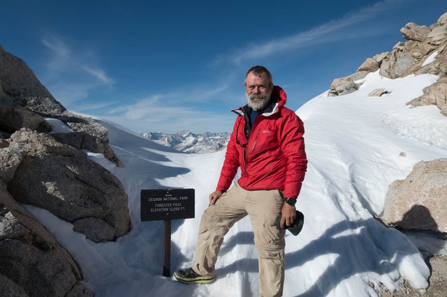
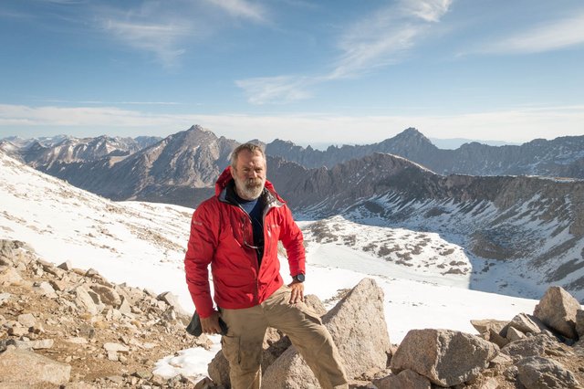
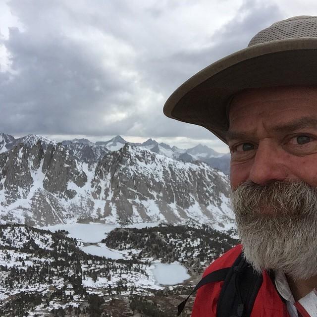
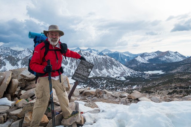
Except we didn't make it quite to the top, as the pass was blocked by a big wall of snow, 8 feet high. We scrambled up and over the rocks to the left of the trail, heading above the pass, and then headed down about 20 feet to the pass itself. The north wind had blown all the snow over the pass to the south, and we stopped and took pictures with the sign. It was 8:00, it was 50 degrees and very sunny out, and we both said "let's get down quickly before the snow gets even more soft."
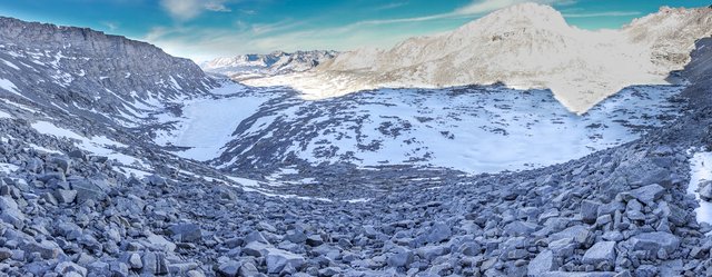
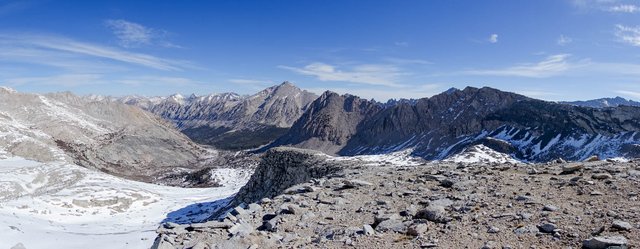
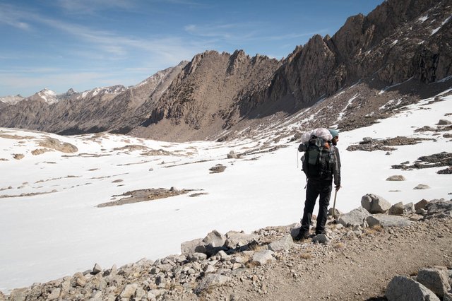
The north side of Forester pass was one big snow bank, with a vague line of scattered rocks level with us heading off to the northwest, and a shallow bowl below us. The trail was completely buried under the snow for a mile or more, nothing visible. I checked my GPS, and saw where mile 780 should be, off to the northwest at the top of a ridge spur, and the PCT did its usual lazy switchbacks to get over there, by heading east first, then switching west/northwest across the bowl below us. That whole slope faces northeast, right into the early morning sun.
We were having none of that PCT lazy switchbacking. We wanted to get over to mile 780 quickly, so we turned left at the pass. Joko scrambled over rocks, I followed, then I said "this is taking too long. Let's scoot on down." I sat down on my butt, held my ice ax, and glissaded down the slope. Whee! It was fun, and I steered myself off, first down the slope then diagonally as best I could, going from rock pile to rock pile.
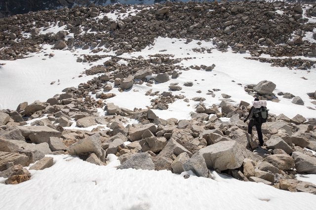
Glissading was a quick way to get down, as long as the slope was steep enough. If the slope wasn't steep enough, I would stop, and have to push, and eventually walk to the next rock pile to plan my next moves. Walking wasn't really an option sometimes, either. The snow was too soft, and I ended up postholing to my knees and higher, so I'd end up half-crawling: ice ax in right hand, left hand on the snow. Drag right foot forward, put left knee on snow, put left hand forward, scootch forward a foot or so. Hard work.
What we thought was the mile 780 waypoint was really not, though--it was on another bump, about 200 meters northwest. We did finally see trail, on a southeast facing slope, switchbacking, so we headed over there. It would have been an easy five minute walk, but it took well over 30 minutes to glissade a short distance, then walk/crawl, then glissade again.
It was at this part that I postholed deep--past my waist, and my right foot was frozen into a pointed down position. I tried to pull it out and felt the shoe coming off. Uh, no. And I couldn't really move it--the snow had solidified around it, and wasn't panicked but intensely focused. I was thinking one thing: dig my leg out, and quickly. The ice ax came out, and three or four minutes later I was able to pull out the leg.
I was fifty meters from the rocky slope with the trail switchbacks, but there's no way the soft snow would support any walking. I crawled, carefully shifting weight around when one limb started to sink too quickly. I thought the silly thought "so I'm now a human tripod", then sobered up. That rock was so far away. Fifty meters, and each crawl stroke is only half a meter at most. One hundred strokes should do it. Do ten stokes, take a breather. Count another ten, take a breather. I made it in some seventy plus strokes, and took a really long breather.
Joko had watched me above, and chose a more inclined slope to glissade down, and joined me a few minutes later. We scrambled up a bit, and found the trail, which headed along the flattened spur, and under yet another snow field. Neither of us felt like more snow crawling. Time to look at the GPS.
The GPS map indicated the trail followed the spur for quite aways past a lake outlet, then made one switchback to meet up with the lake outlet. We continued down the spur, making our way along the rock, avoiding tightly spaced lines on the GPS topo map that said "there's a 100 foot cliff just a bit to the right". It was super-hot too--cloudless, no wind, maybe 55 degrees. We were working up a sweat.
After twenty minutes of scrambling (maybe less--time seemed to be irrelevant when we were so focused) we found the trail on top of the spur, with incredible scenic views.
Following the trail along the spur, we got to the single long switchback and tracked that down to the lake outlet, though we bypassed the snow-covered lake outlet by working our way across a rocky bridge to the opposite side of the shallow gully. We were down, and at mile 781. It was 10:00, and we'd travelled two PCT miles in around three hours.
Just because we were down off the slopes, though, didn't mean that we were home free: in front of us was another mile of snow, on rolling terrain and flat ground. There were very few rocks sticking out of the snow, so we headed for the outlet of a lower lake, again dotting-the-dots of the few rock outcroppings, and postholing along the way. On one of the postholes my right shin got dragged along the sharp edge of a rock, making a gash/bruise a few inches long.. I have a feeling I'll be calling that my PCT Scar :-)
It wasn't until mile 782 that the snow mostly cleared, and we were relieved; there were even trees here and there. But then the trail ducked along a northwest/north slope, under the shady trees, and with plenty of snow banks and drifts covering the trail as it descended along the hillside. I decided we just needed to head down to Bubbs Creek and cross-country hike for a mile to meet up with the PCT. The snow isn't quite so dangerous as the slopes, but it's a lot softer and so much easier to posthole.
After scrambling through the scrub willow and snow runoff for a mile, I looked on the GPS, saw the PCT was just 30 meters northeast, and said "let's rejoin". The snow had mostly disappeared, though there was still some final patches to cross. I actually crossed over the trail on a snow patch, went a few meters beyond, was confused and said "where's the trail???" and Joko behind me said "oh, you crossed over it--it's here under the snow", and then pointed at the edge of the snowfield where the trail emerged.
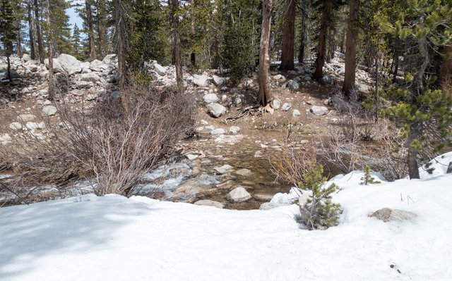
Whew. That was rough up and over Forester Pass. We stopped few minutes at the Bubbs Creek crossing, with a campsite, and we needed a break to dry out clothes and get a bite to eat. We'd travelled less than five miles in six hours, and were pretty exhausted. We took off our wet clothes, dried them in the warm sun (it was over 60 degrees, crazy warm for early spring at 11,000 feet), and had some lunch--it was a bit over five miles in five hours.
So now... what's the plan? We had planned back in KM to head out Kearsarge Pass to Independence and then Lone Pine to resupply. Joko was picking up a package at the post office, I was just getting food, we both wanted more than a night in town. Let's see how far we can go; while we both were pretty tired, our hour-long rest stop helped perk us both up a bit.
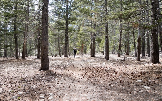
The trail for the miles after Bubbs Creek was great--slightly downhill and fast--and we made great time to Vidette Meadow, where there are several campsites (and bear boxes). I had planned to stop for the night there, but we both were feeling perky, and there was a good four to five hours of sunlight left. I thought "we could make the trailhead at Onion Valley, up and over Kearsarge Pass, even at two hours an hour, and hitch a ride down to a comfy motel bed. If we're tired, we'll just camp at Bullfrog Lake." Joko just agreed to press on.
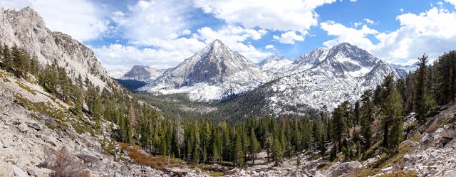
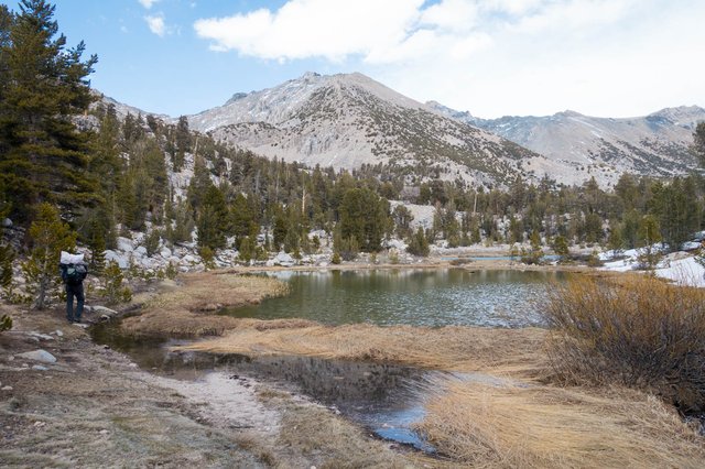
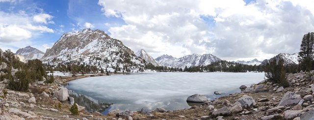
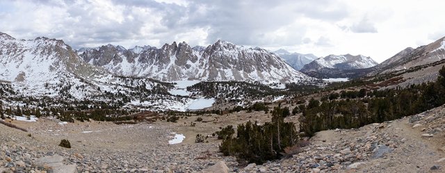
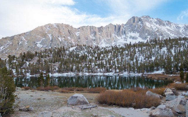
So we kept going. There was the Cedar Grove trail junction, leading 13 miles to the road's end to the west. We were heading up and over the pass to the east, about eight miles, and we slogged away. The scenery was wonderful--half-frozen lakes nestled in tree-covered valleys, jagged snowy mountains as a backdrop, it all sounds very postcardy, and it was simply spectacular.
It took awhile to ascend Kearsarge Pass, and we finally got up to the top around 6pm, with a few snow showers near the top. The pass is known for being "easy", and it was, kind of, as the trail on both sides faces the south, so it's generally free of snow much earlier than many passes. We appreciated that. We also encountered two mountaineers headed up to climb Mt Clarence King, named after perhaps the first recreational mountaineer in California, and a contemporary of John Muir.
The five-ish mile trail down to the trailhead was a steady downhill, descending from 11,700 to 9200 feet. We could see the trailhead parking lot for quite a few miles, and I was slightly disappointed that there weren't any more cars or activity--it'd be tough to get a ride down the hill. At sunset, we got to that parking lot and waited for a bit. No one was coming or going, so we called it a night and camped nearby--a very full and very energetic day.
