Victoria River Crossing, Northern Territory, to Fletcher Creek, Western Australia
What is it about the Kimberley? We've been here for all of a day, and it's magnificent: huge red mountains, interesting plants, and interesting roadside stops. Today we made our way across the rest of the Northern Territory, with a few hours at Keep River National Park to look at rock art and the scenery and some curious Aboriginal hunting huts, then we cross into Western Australia and bush camp just before the turnoff to Purnululu National Park, home of the Bungle Bungles.
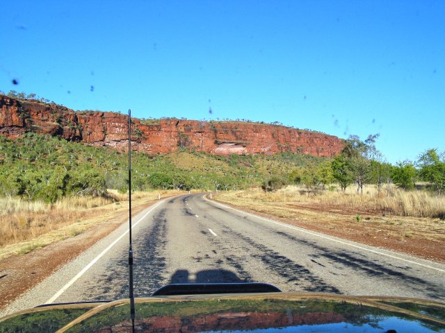
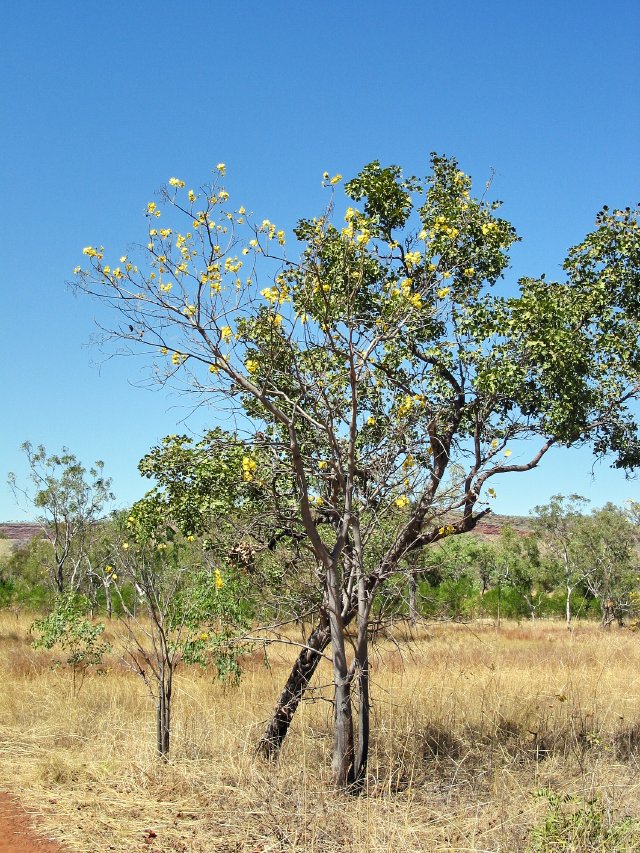
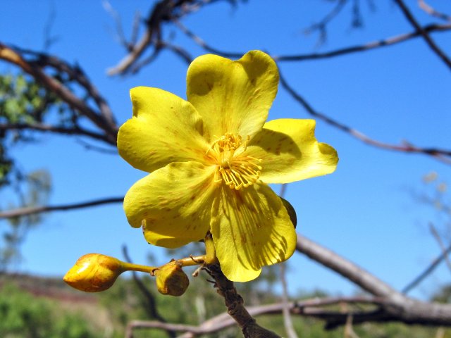
It's a long driving day, but one full of interesting sights. We left the somewhat disappointing Victoria River Roadhouse campground right at 8, and headed west. The sun was just coming up, and the highway curved along the river valley, with the deep red escarpment on either side and the batwing coral trees and the kapok trees blooming red and yellow long the river flats. Our first stop was at the Kulang lookout, where we got an expansive view over the countryside.
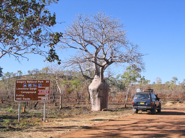
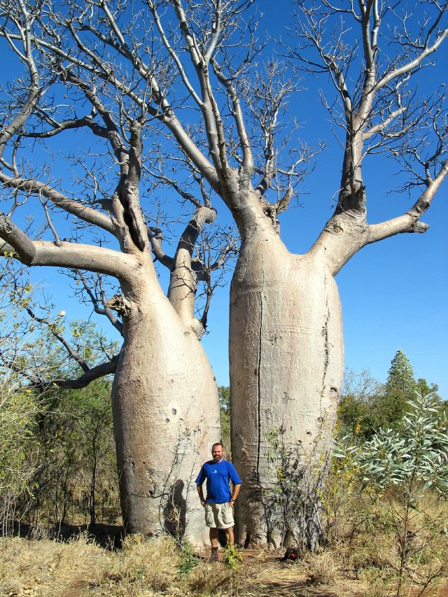
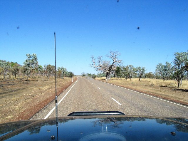
We then continued our westward journey, and soon saw our first boab tree! Boabs are related to the African baobab tree, which has a huge swollen trunk and little branches at the top. Curiously, the boab trees in Australia are a relative newcomer--they've arrived fairly recently, probably as seeds that drifted over from Africa. This time of year, they're out of leaf... with the Dry season, they lose their leaves to conserve water.
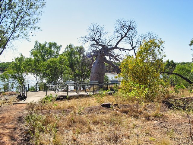
It wasn't soon after that that we came upon Gregory's tree. Gregory was an early Australian explorer, who extensively surveyed the northern part of Australia from a base camp he'd established about 100 miles up the Victoria River. Today, you can still see the date of the camp carved into a huge boab tree just up from the river dock. It says "July 2nd 1856". While he was an explorer, he was rather matter of fact about his description of the country, noting that in his journeys far south of the camp he'd run into a Great Sandy Desert, and that much of the country didn't amount for much. There were very few nuggets of optimism in his report, but they were enough for eager pioneers to seize on and settle the country he described. Quite a few met up with disaster, but others were able to struggle on and establish an ongoing cattle grazing industry.
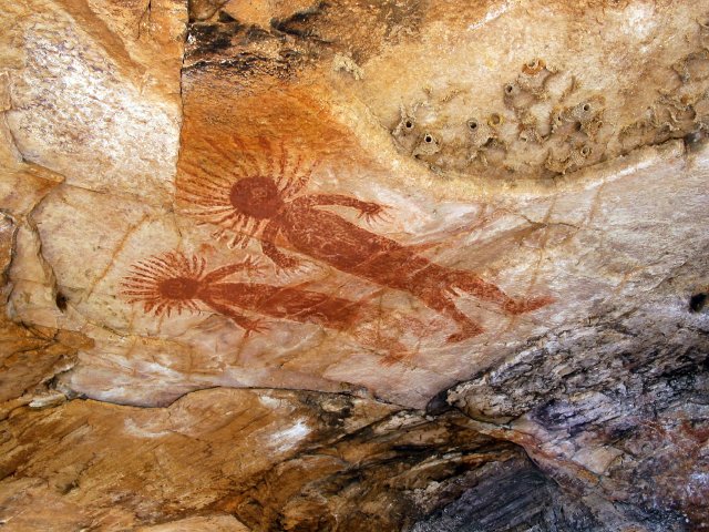
From the Gregory Tree, it was a bit over an hour to Keep River National Park, on the WA border. I'd wanted to go here for quite awhile, because I'd heard it's beautiful. It was pretty nice, but I thought the Victoria River escarpment was prettier. We took a walk to a somewhat OK rock art site, where we saw another rendition of the Rainbow Serpent and some Windjana like figures. The Rainbow Serpent is believed by many Aboriginal cultures to be the creator of the land; the Serpent's movements across the land created the mountains and rivers and valleys, and it's a very common theme, as well as a very sacred one. A painting of the Serpent is equivalent to a crucifix in Catholicism. The Windjana figures are paintings of humans with rays coming out of their heads--think of the Statue of Liberty. Sometimes, they're also painted with halos around their heads as well, Personally, I think they're headdresses, but if you'd like an alternate explanation on what they mean, you can go read that 1970's classic Chariots of the Gods, which you can probably find for 50 cents in a dusty corner of a used bookstore.
We drove all the way to the campground at the end of the road in Keep River NP, but weren't too thrilled with it's look--a big open space with a dozen or so campsites around. And we were feeling lazy after a very yummy lunch. On the way into the park, we'd stopped at the info board, and ran into two older couples having lunch--and giving away fruit and vegetables from their coolers! With the Western Australia agricultural quarantine checkpoint just a few kilometers away, they didn't want their veggies to go to waste, so they pawned off on us three tomatoes and half a carrot, which we added to our sandwiches. Yum! Now, with our bellies full, and looking at a 6km hike, we just said 'nah', and turned back to the park entrance.
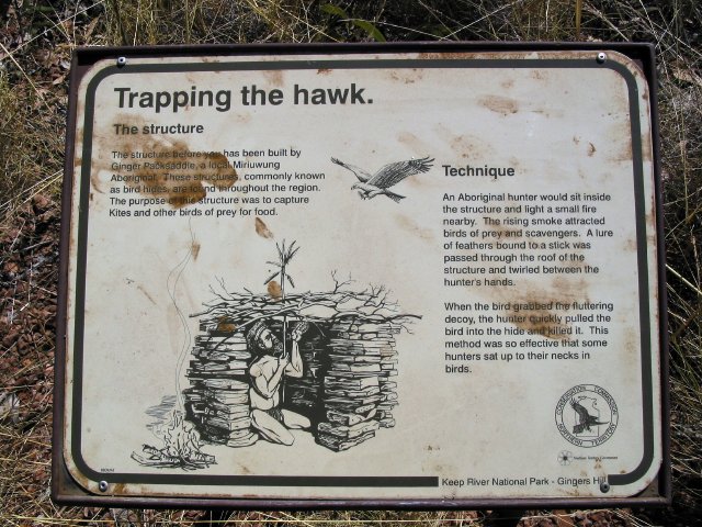
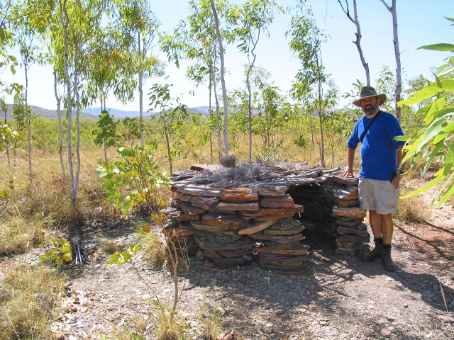
On the way back to the park entrance, we did one more short hike of just a kilometer. This was to the bird blind on top of Ginger Hill. It's something of a myth that Aborigines did not build any structures; they did build semi permanent huts of branches and bark, and here they built an ingenious hunting hut. It's best described as a very short circular hut, about waist high, and just about big enough to sit in if you sit cross-legged. There's no roof, but there is a grid of sticks and branches. Outside the hut is a small fireplace. The way this is used to hunt is simple. Birds in Australia are lured by smoke, they know that when there's a bushfire that small mice and marsupials flee in front of the flames, or are left without protective cover once the fire's gone through. So the birds see this small fireplace fire, come in and have a look. They see the hut. Now the hunter inside the hut has tied a feather to a long stick, which he sticks through the roof of the hut. the bird sees this, hops up on the hut's roof to investigate--and the hunter grabs the bird. It's a very easy and successful way of catching birds, and the hunter's able to catch all sorts of birds, including falcons and the wedge tail eagles that are so common in Australia.
Back on the road, we went through the checkpoint at the WA border, where we dumped our honey and stupidly forgot that we had a bag of spinach in the fridge--so out it went! All in all, it was pretty much the same as the checkpoints on the roads coming into California. Then it was a quick thirty minutes to Kununurra, the largest town in the eastern Kimberley. It's one of those mining towns that was developed in the 1960's as a somewhat temporary town but now is a bit more permanently settled, especially after the Ord River was dammed upstream from the town and cheap water and hydroelectricity became available. We were shocked to see that they grow sugarcane there, in the desert! Why anyone would want to do that is beyond me. If they can't grow it profitably in northern Queensland, how can they expect to compete growing it in the middle of the desert?
Kununurra did have quite a few services, though. We stopped by the CALM office (Conservation and Land Management, which runs the National Parks in Western Australia, as well as handling forestry and wildlife) to pick up some literature on the national parks and buy a parks pass. We also dropped by the newsagency and a souvenir shop so that Chris could indulge his fridge magnet fetish once again. And I finally bought the "Free Camping in Western Australia" booklet for $11, which Chris promptly ragged on me for. He thought it was stupid and amateurish. Sure, it looks like it was done on someone's home computer, and the maps are crude hand-drawn maps, but $11 is about the price of a campsite at one of these remote roadhouses--and if it saves us just one night, it'll pay for itself. I just think Chris gets weird about bush camping because it's not 'proper'--with bush camping, you don't ask permission to camp, you just see a campsite and take it. Unlike the US, people in Australia generally camp anywhere unless there's a no camping signs, so you'll see people camped at roadside parking areas, rest areas, creek crossings, you name it. It's commonly accepted that it's OK... though I like it because it's free, and you don't have to deal with the often-crowded commercial campgrounds.
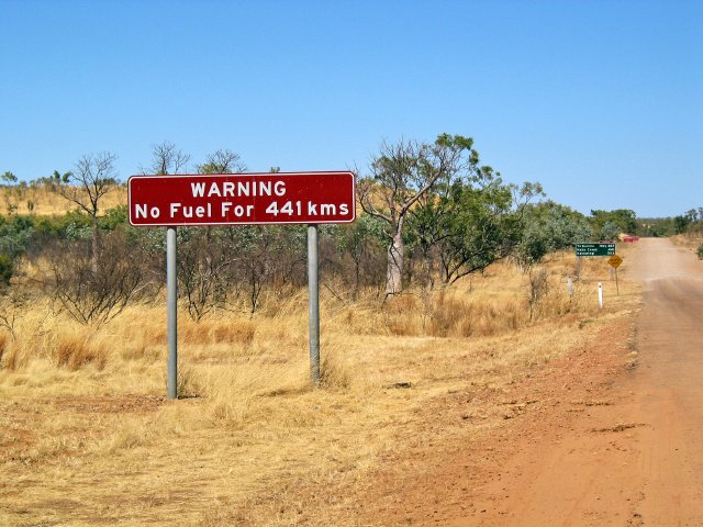
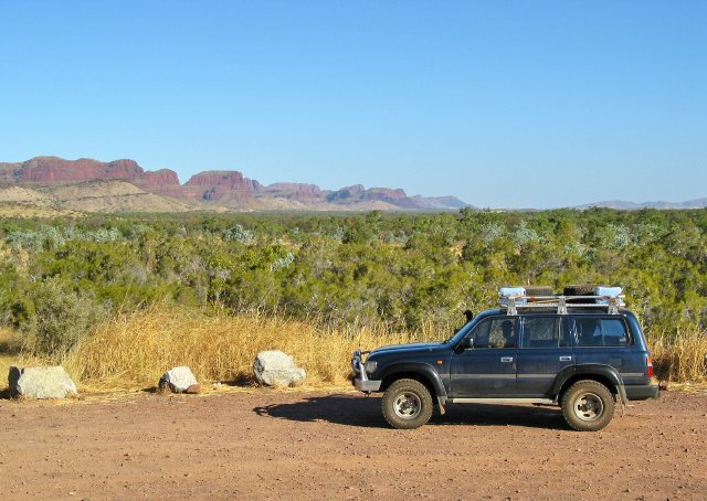
After we filled up with more groceries at the Coles in Kununurra (including more spinach!), we headed towards the Purnululu NP turnoff, with the simple intention of driving until it got close to sunset, then finding a spot. The scenery became even more dramatic as we turned south onto the road to Halls Creek, with large red mountains on either side of us. The road was in excellent condition for the first 150 kays south of Kununurra, too, with huge sweeping turns and big road cuts through the hills and around the mountain spurs. It got a little narrower after that, going down to a width just wide enough for two LandCruisers to pass each other, but the scenery actually got better--the mountains now took on a horizontally layered look. So far we're really liking Western Australia; we think this is the most interesting country we've been in since Mt Isa in Queensland almost two months ago.
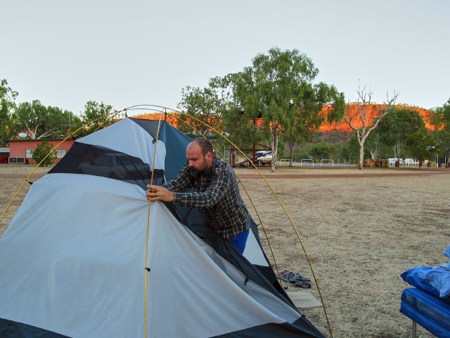
Finally, after consulting our new Free Camping book, we pulled off the highway at Fletcher Creek crossing--which actually was a crossing, with water in the bottom--and set up camp about 30 minutes before sundown. There, we battled the flies for an hour before they went away (who knows where), and had a yummy meal of pumpkin soup mopped up with some old stale bread.
Weird Wildlife Sighting
Two today--one plant, one animal!
The plant was Our First Boab tree. Chris spotted the boab right at the Bullita Downs road, just south of the highway. Yep, it's a boab!
The second was just as we were pulling into our camp. It was a feral cat--and it had jumped three feet in the air when it heard our approach. At first, I thought it was a quoll or something, but no, it was a cat.
