Innamincka and The Dig Tree, South Australia (and Queensland)
A day wandering around Innamincka, visiting various Burke and Wills historical sites, including both their graves and the Dig Tree.
Cappuccino is the official drink of the Outback. Today, some tourists were pleased as punch when they found they could get a cappuccino at the Innamincka General Store--the only store within a five hour drive. And day before yesterday, the woman at the Birdsville tourist info center was pleased as punch, almost smug, when she exclaimed that Birdsville has two places to get cappuccino!!!! What is it with Outback towns and cappuccino? They get their mail only once a week in Innamincka, but they can make you a cappuccino any time you want! Whoo hoo!
Innamincka is Cooper Creek's major metropolis, but it's not where the Dig Tree is located. That's about an hour's drive east, just over the border in Queensland. We left our campsite early in the morning... and left camp set up. It's not like anyone's going to steal anything... all, and I mean all, of the other tourists are family Australians with kids and trailers in tow. Not a German to be seen!
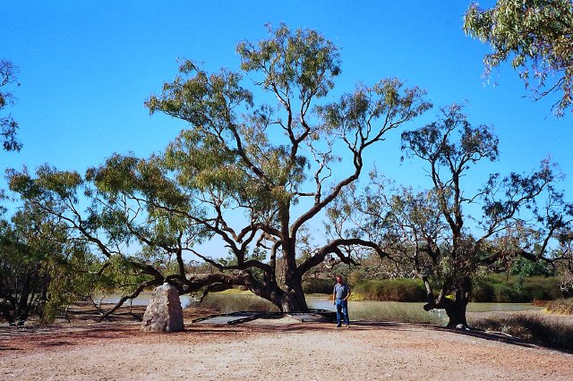
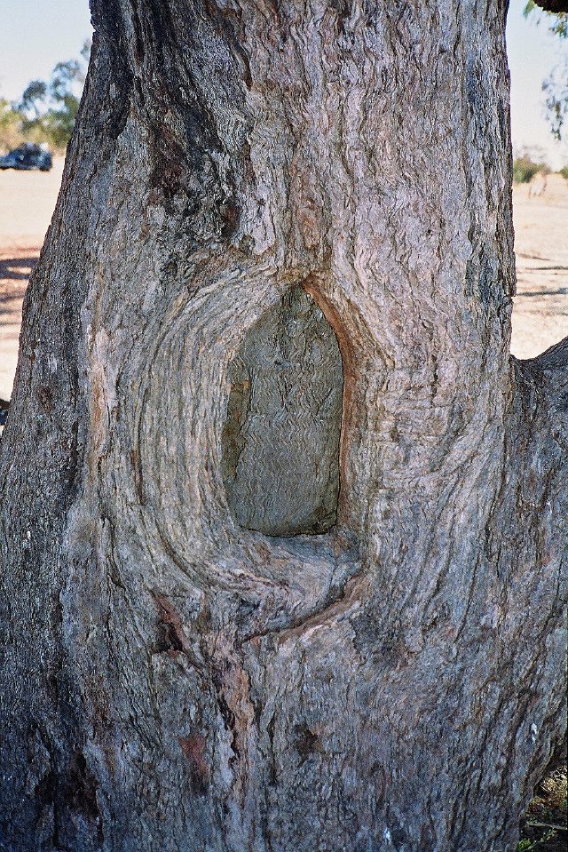
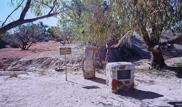
The Dig Tree itself, well, is an old coolibah tree (a kind of eucalypt). Of the three carvings that were made, the only one that you can see today is one that says "B LXV" which is marking that this is Camp 65 of the Burke and Wills expedition. That story's been told quite a few times, but basically Burke and Wills were chartered by the haughty Melbourne upper-class to cross the continent (and perhaps even claim a little slice of land for Victoria colony as well, before those other nasty colonies like South Australia got there first). Burke had no previous experience exploring, and made quite a few blunders such as over-equipping his expedition--he brought along an iron bathtub!--and choosing to head through Central Australia in the middle of summer, when it's miserably hot and rainy in the tropics to boot. You can read more about it in The Dig Tree by Sarah Murgatroyd, an excellent book just a year or so old.
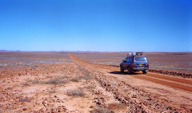
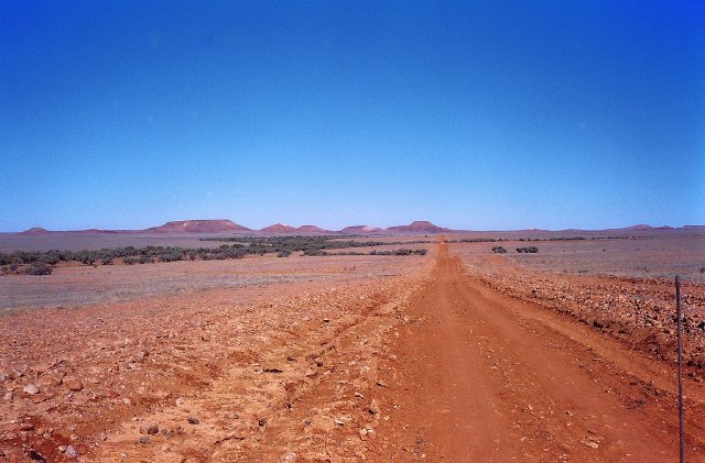
Getting to the Dig Tree from Innamincka, you pass through a variety of scenery on the 80km journey: you have Cooper's Creek, which is a broad shallow valley lined with river red gums and coolibahs. Then uphill you have vast stony plains with grass here and there. In a few places are some red sand dunes, and then off to the north are mesa formations. The curious thing is how Burke and Wills would find their Dig Tree camp--the Dig Tree isn't prominent at all, it's just one of thousands lining the creek. I wonder how they found it, because when you get down in the creek valley you can't see any of the more distant landmarks at all. It's just sandy plains and coolibah trees.
We had the Dig Tree to ourselves for about three minutes. Then ten people poured out of two LandCruisers, and that was it. Most ran right up to the tree, past the huge info board about it, and started looking at the tree, asking silly tourist questions: "Is the carving under that concrete?" No, if you'd have read the board, you'd know that concrete was put in one cavity to stop termites in 1960. And so on.
Anyway, we took the less popular route back to Innamincka, on the 80km flood bypass route--and didn't pass a single car. It was a great drive. The countryside changed yet again, strongly reminiscent of eastern New Mexico and west Texas: rolling plains with mesa ridges in the distance, and brush lined creek beds. It's the first part of outback Australia I've seen that can pass for any place in the American west. All the rest of the landscapes we've seen have been too stony, or too flat, or too sandy, or just too spacious.
Back in Innamincka, we hit the three sites of Burke and Wills near town: the two graves, and King's 'find' site. King had traveled with Burke and Wills, but after their deaths was fostered by some local Aborigines before he was found by a rescue party. I like what the doctor of the rescue party said about his condition: "he was wasting away for lack of European food, as he could not survive on the Aboriginal diet." Uh, yeah.
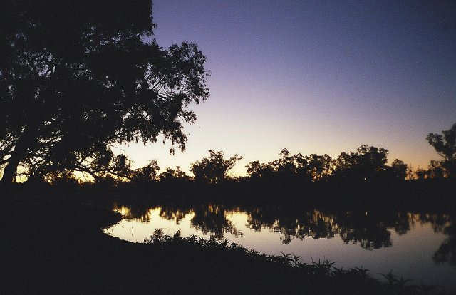
After that, we went back to our camp and relaxed... and planned a bit while we watched the budgies fly overhead in huge flocks and the pelicans patrol the waterhole.
Planning is interesting. We have to be at the Billabong Roadhouse, east of Kalbarri in Western Australia, on 31 August. And we have a fancy shmancy sunset dinner at Uluru on July 20th, and we want to stay at Davidson's Guesthouse in Arnhem Land sometime. But looking over the next eight weeks, it looks a bit tight:
- 4 days around Alice Springs, stocking up and seeing the stuff around town
- 4 to 6 days in the West McDonnell Ranges west of the Alice
- 2 days at Uluru and the Olgas
- 4 to 5 days at Kakadu
- A couple of days at Litchfield
- A few days in Darwin, plus a trip out to the Tiwi Islands
- Three weeks or so in the Kimberley
- A week or two around the Pilbara and Ningaloo in WA
And it all adds up. So we'll just head for Alice, then Uluru and the West McDonnells, the East McDonnells, the Top End... and get to Arnhem land by the end of July. The Kimberley and Pilbara will be August. We'll visit Shark Bay after our CALM expedition. Or maybe before. It's a bit far out.
Weird Wildlife Sighting
Plenty. A pair of brolgas in front of our campsite. Pelicans patrolling the Cullybarra waterhole in front of our campsite. Flocks of budgies, green and yellow, flashing by. Lots of birdlife is about.
